Iran Plumes
It has been a dark week for the United States following the bombing of Iran. Given the many reports of fires in refineries, I was curious to see if I could build a system to view and track fires.
Claude quickly whipped up a dashboard that pulled together satellite image with wind direction and additional atmospheric content (NO, SO, CO). I had to signup for a few APIs, but everything worked pretty well in terms of getting the data and doing some pre-post comparisons. However, the project really wasnt what I wanted to do.
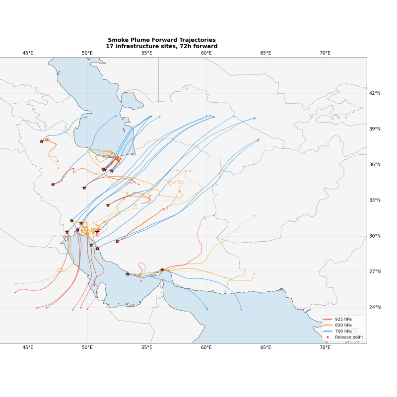
I really wanted to view smoke and plumes from space. Claude made a few quick fixes and generated some amazing maps. Conceptually everything is sound, but in all honesty I didnt rigorously test accuracy. I think this focuses too much on existing "known" sites of oil refineries and storage, and not necessarily random smoke from a buring refinery.
Also, it's pretty impressive that Claude knows the lat/lng of some of these places...